#TRAFFIC A crash has closed all southbound lanes of Abercorn Street at Television Circle, according to Savannah Police
The St. Andrews Fire Department and Charleston Fire Department responded to a structural fire on the 700 block of Catawba Road
Man dies after falling from Myrtle Beach balcony while doing handstand during Hurricane Ian
Police are investigating a shooting that injured two people in North Charleston
The North Charleston Police Department responded to a shooting call on English Street, finding one building and two cars struck by gunfire
The Charleston Police Department says a "possible emergency situation" at Burke High School appears to have been a hoax
Savannah Shooting: Police confirm 1 man injured on Cape Street, investigation ongoing
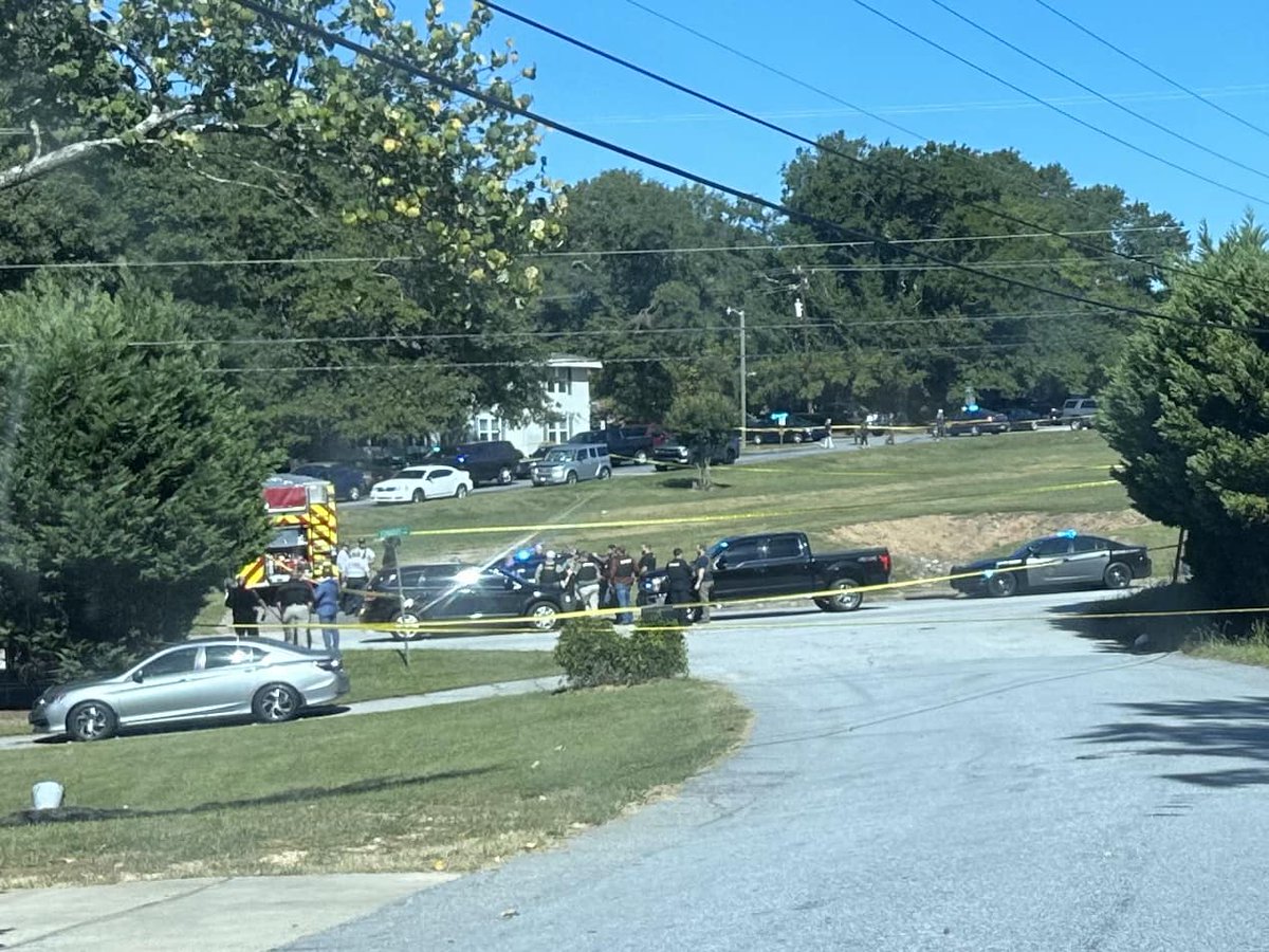
Roads are currently closed in the area of Reid and America St due to a structure fire. Residents are asked to avoid the area until further notice. We will update once the scene is clear
 3 year ago
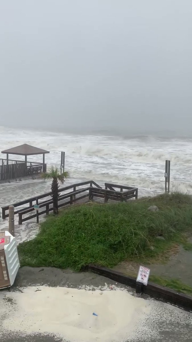
Huntington Beach State Park is still not open to the public after receiving damage during Hurricane Ian Friday. Flooding was the major issue here, along with dune erosion & boardwalks destroyed.
The suspect accused of shooting a man at the intersection of Main & Washington Sts Saturday has turned himself in to ColumbiaPDSC investigators. Kenneth Cannon, Jr. is charged with attempted murder & possession of a weapon during a violent crime. No county jail booking photo yet
 3 year ago
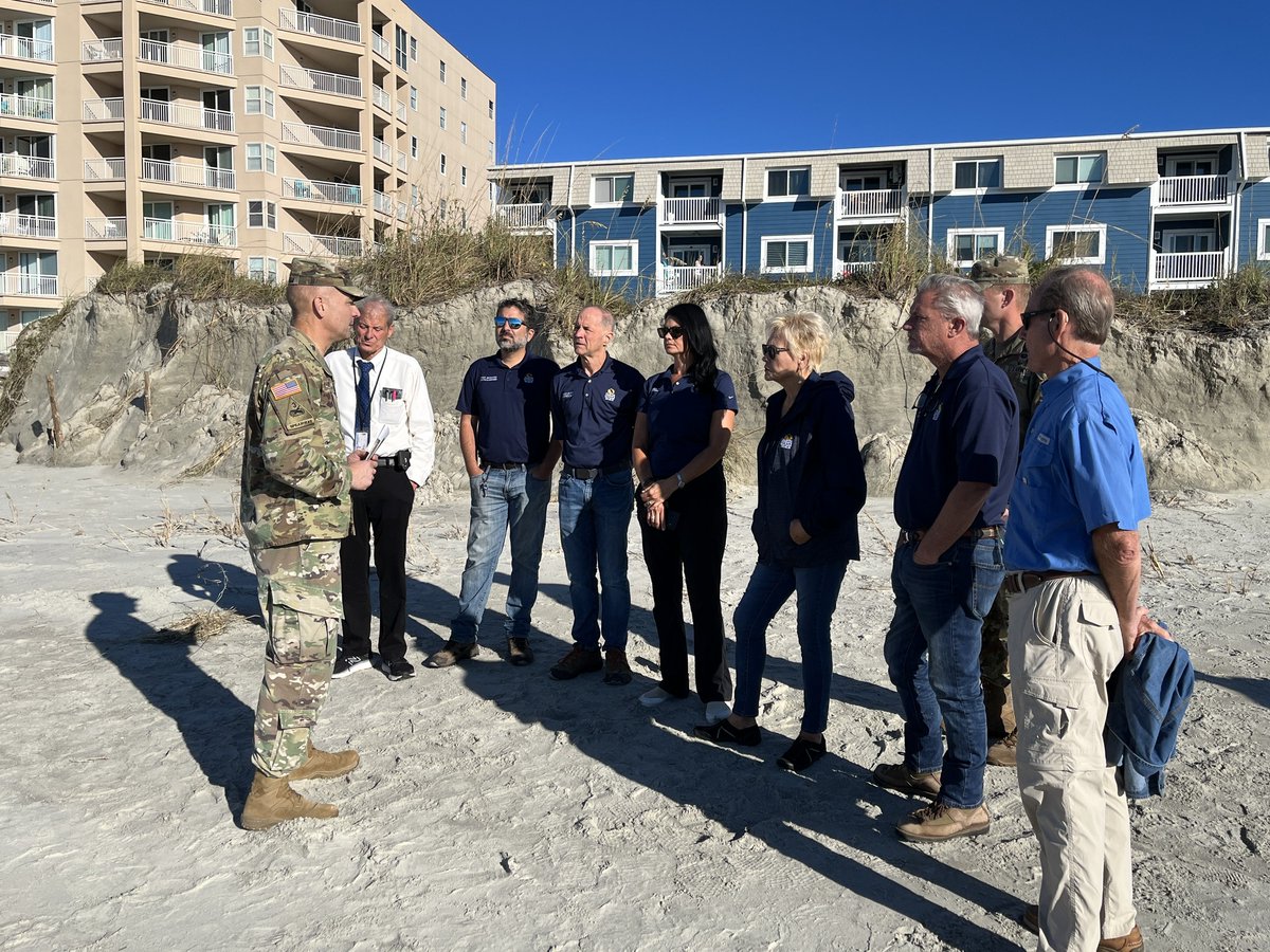
North Myrtle Beach city leaders met with the Army Corps of Engineers this morning to survey Ian damage
 3 year ago
Officials are saying three homes were damaged during the fire in a Garden City neighborhood Friday night
The Andrews Police Department is investigating a Friday afternoon shooting that left two women and the shooting suspect dead
 3 year ago
Myrtle Beach Fire crews responded to 316 4th Ave S for a structure fire. There was no fire, but Truck 6 rescued 4 people who were trapped on the second floor due to flooding in the area.
More than 90K without power across Lowcountry
 3 year ago
Waves crashing on Cherry Grove Pier
 3 year ago
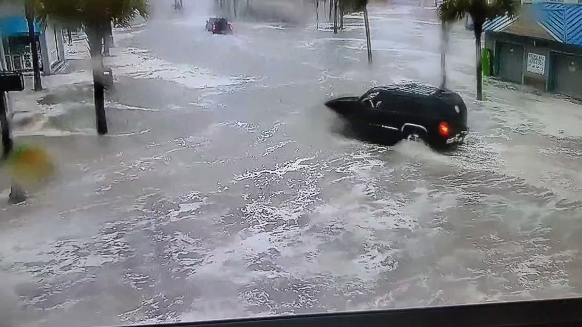
Flooded roadways. Take another route and stay safe. This is 3rd Ave S and Ocean Blvd. There is no reason to take this risk
 3 year ago
Storm surge from Ian continues to worsen in Garden City Beach, South Carolina
 3 year ago
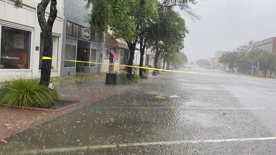
Water is accumulating quickly on Front St. in Georgetown. Drains are beginning to back up
MYRTLE BEACH FIRE: Crews are responding to a structure fire at 100 Cedar St
 3 year ago
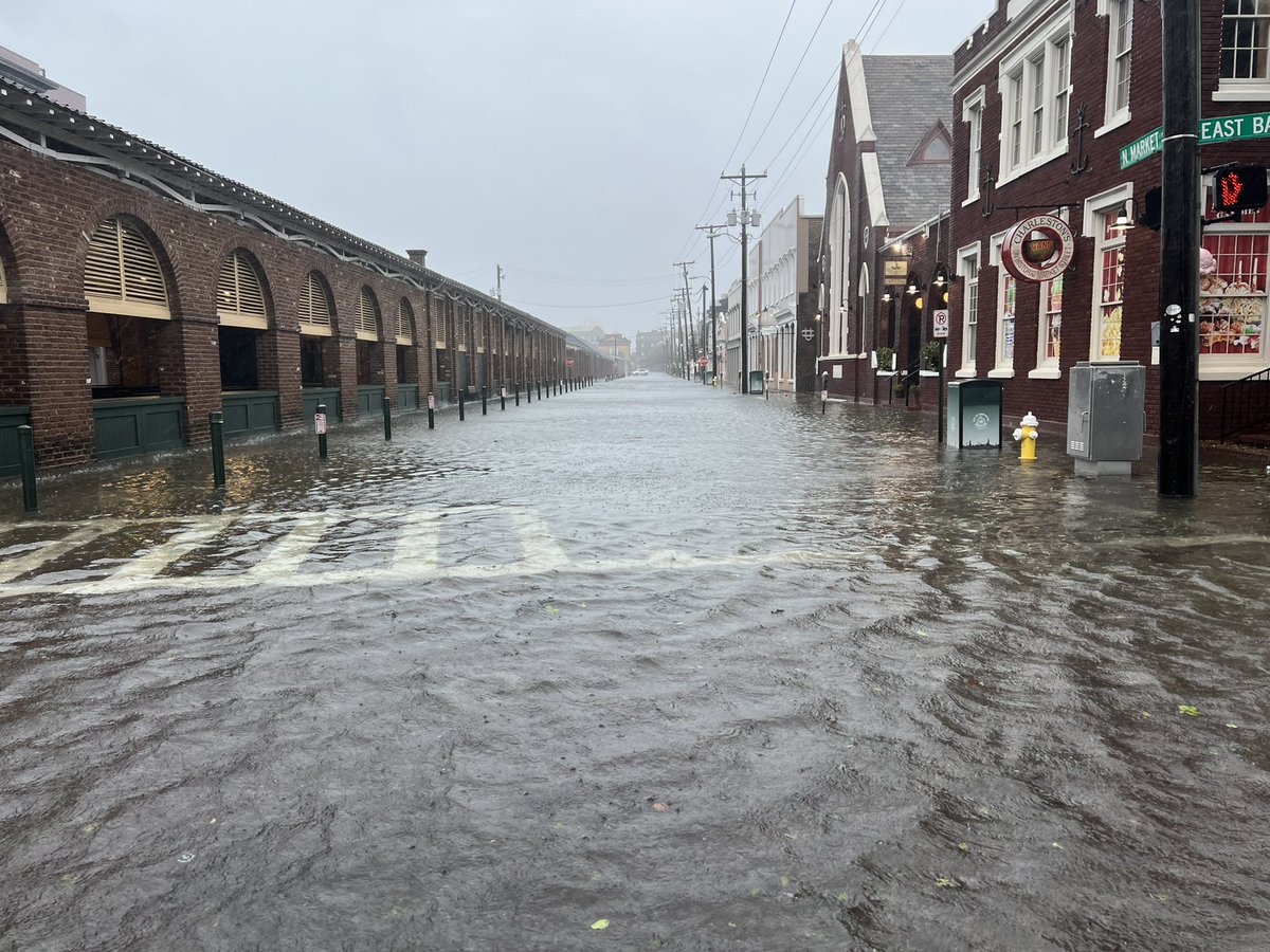
The Market area is now starting to flood in downtown Charleston
Crews are on scene of a structure fire at 100 Cedar St in Myrtle Beach. Occupants have been evacuated and crews have extinguished the fire at this time. No injuries have been reported at this time. Please avoid the area for your safety and the safety of our crews
Crews are operating at a structure fire on Cedar Street
 3 year ago
Dorchester County Fire, Police and EMS crews responding to a fire at the Summerville Station Apartments. Officials say multiple units are destroyed, and there are several injuries
 3 year ago
A massive fire is roaring in Summerville. scene and working to learn what's happened and if/how badly people are hurt
The Greenwood Police Department is investigating after a shooting killed one person and injured two at an apartment complex
The Greenville County Coroner's Office said they are responding to a crash on North Poinsett Highway and Tubbs Mountains
 3 year ago
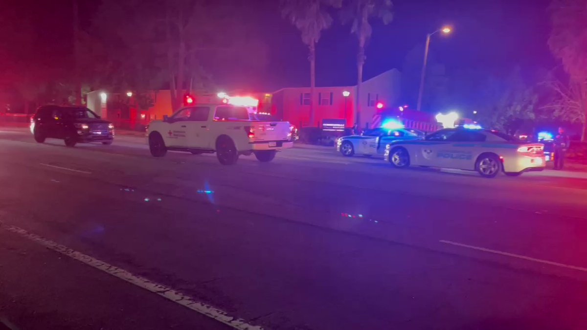
Following contact with the armed suspect, an officer involved shooting took place. SLED is currently on scene conducting an investigation. A press briefing will be conducted by Sheriff Lewis at a later time today
Huge law enforcement presence on scene of deadly deputy-involved shooting
The coroner was called Wednesday morning to a shooting involving a deputy in Greenville County.
South Carolina news on live map
Colors on the map
 U.S gov
 Authoritarian countries, far-right, far-left groups, and Donald Trump
 Terrorists and criminals
 Non-government organizations and groups
 Non-aligned, Nature
 Solar eclipse on 21 August
Path of solar eclipse on 21 August Areas
Blizzard/Winter storm warning Icons
 Road accidents, cars
Artillery, MLRS Airplanes, jets Helicopters Camps, tents Captured Dead Stabbing attacks Fires Injures/medicine Firebombs Police Gun shooting Speech, statement Stop, road block Tanks, APCs, armored vehicles Thugs, people in masks Nuke, radioctive materials Ship, Warship Gas, chemical weapons Drones, robots Rally, Protests, Demos, crowds Hostages and Refugees No Connection, Jamming, Radar Rifle Gun, armed men Explosion, blasts Shelling Trucks Hackers, computers Picture(photo) Food Money Press Phone Fort Video Destruction Landmines, IEDs Crane, construction Railway House Anti-air, SAM No Water Rocket Submarine Twitter Facebook Electricity, blackout Biohazard Nature, disasters Stocks Transport or civil plane Rescue operation Natural resource Mobile, applications Drugs Earthquake Floods Tsunami Animals, wildlife Sports Map Volcano Snow Pollution Manpads Corruption Satellite Alcohol Arrested Sun Bus Animals: Cat Animals: Dog Stocks Down Animals: Snake ATGM Animals: Panda(rare animals) Animals: Horse Animals: Cow Animals: Lion Animals: Shark Animals: Wolf Supply Flares Animals: Bear Machine Gun Stun grenade Airplanes: light plane Motobike Balloon Bulldozer Cruise Missile FPV drone Map Change Event Missile Airborne Quadcopter(Mavic) Large explosive drone(Shahed) Tractor Tunnel Air Alert Aerostat, High-Altitude balloon Attention! All events and areas of control on the map are geolocated approximately